Due to its diverse geographical conditions, Peru has a large diversity of climates; from desert climate to mountain climate to tropical climate and anything in between. So questions such as “What’s the best time to travel to Peru?” or “How is the weather in Peru in February? In December?” are impossible to answer.
Content overview:
- Geography and climatic zones of Peru
- Climate and Weather in the coastal region of Peru
- Climate and weather in the Andean highlands of Peru
- Climate and weather in the Amazon rainforest of Peru
- Best time to travel to Peru
Geography and climatic zones of Peru
Peru is located in the southern hemisphere and roughly stretches from the equator - its northernmost extreme is just 3 km (about 2 miles) south of the equator - to about 17° south.
Despite being entirely in the tropics where you would expect a warm to hot and humid climate year-round, the unique combination of tropical latitude, the Pacific Ocean with the cold Humboldt Current (and in some years the El Niño phenomenon), the Andes Mountains range and variations in topography provide the country with a large diversity of climates from warm and arid desert climate to temperate, frigid and polar mountain climate to hot and humid tropical rainforests and anything in between.
Broadly spoken, there are three main climatic regions in Peru: the coastal region named costa in Peru (yellow) with an arid climate, the Andean highlands called sierra (orange) with a mountain climate and the Amazon rainforest called selva (green) with a tropical climate.

Climate and weather in the coastal region of Peru (yellow)
The coastal region of Peru extends along the Pacific Ocean from the northern border with Ecuador to the southern border with Chile and covers 12% of the Peruvian territory. The coastal plain is characterized by barren, rocky or sandy and extremely dry deserts, beautiful beaches, and to the east towards the foothills of the Peruvian Andes fertile valleys. The arid climate ranges from hot to warm to cool with high humidity and some special features which are mainly caused by the unique location between the Pacific Ocean and the Andes.
The cold Humboldt Current which runs off most of the Peruvian and Chilean coast moderates the heat of the tropical sun but produces high humidity with clouds and mist. The Andes Mountains to the east prevent the tropical climate, including storms and rains, from the Amazon basin reaching the coast.
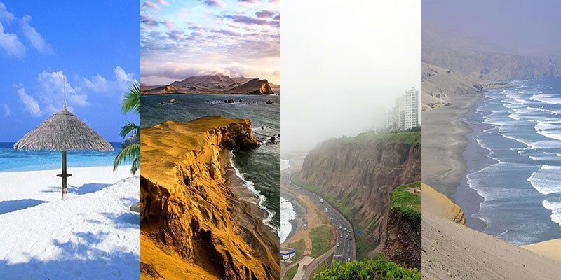
Along the northern Peruvian coast, where the influence of the Humboldt Current is lower, you find the Sechura Desert, one of the driest on earth, with hot to warm sunny summers (December to April) and temperatures around 35 °C (95 °F) during the day. In winter (June to October) you can expect cloudy skies, day temperatures of around 30°C (86°F) and cooler temperatures as low as 16°C (61°F) at night.
The central and southern Peruvian coast, however, is heavily influenced by the cold Humboldt Current. Relative humidity is very high and produces quickly passing morning fogs from December to April and low clouds and mist from May to November. Sunny, moist, and warm summers (December to April) with average temperatures of around 24°C (75°F) are followed by cloudy, damp and cool winters (May to November) with temperatures as low as 10°C (50°F) and a persistent fog called garúa. However, the further you get away from the coast towards the foothills of the Andes mountains, the drier, sunnier, and warmer it gets.
And the weather in Lima, located on the central Peruvian coast nestled between the Pacific Ocean and the Peruvian Andes, is another story. So, we dedicated an extensive article to The Weather and Climate in Lima.
The further south you travel along the Peruvian coast, where the Peruvian coastal desert merges into the Atacama Desert - by the way the driest nonpolar desert and the largest fog desert in the world - the dryer and warmer it gets.
Climate and weather in the Andean highlands of Peru (orange)
The Andean highlands, which cover 28% of Peru’s territory, is the mountainous area dominated by the Andes that extends to the east of the coastal region and runs the length of Peru from the northern border with Ecuador to the southern border with Bolivia.
With elevations mostly above 2,500m (over 8,000 feet) and many snow-capped and glaciated peaks with more than 5,000m (over 16,000 feet), from which 37 are over 6,000m (nearly 20,000 feet), it’s usually cool, often cold in the Andean highlands. However, depending on many factors such as latitude, altitude, formation of the terrain, exposure, cloud cover, etc. a variety of microclimates with temperatures from temperate to icy and lots of rain to dry can be found.
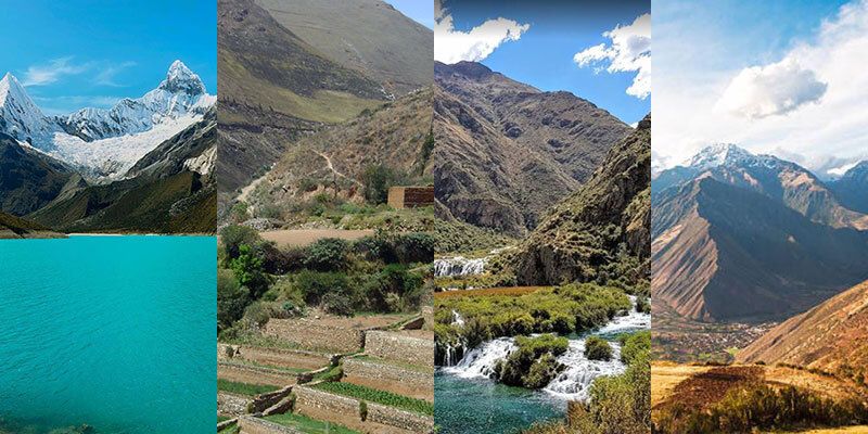
Generally speaking, there are two main seasons in the Andean highlands:
- the rainy season in the southern hemisphere winter which runs from October to April in the northern highlands (for example Cajamarca and Huanuco) and from around November to March in the southern highlands (for example Cusco and Puno)
- the dry season in the southern hemisphere summer from April in the south / May in the north to September in the northern / October in the southern highlands.
The coldest months in the Andes Mountains region are June and July, while November and December are the warmest.
Climate and weather in the Amazon rainforest of Peru (green)
The area of the Amazon rainforest is the lowland jungle of the Amazon basin in eastern Peru, covering 60% of the country’s territory. Here you find hills, vast plains and an immense impenetrable rainforest which is almost completely uninhabited.
In the northern Amazon rainforest, it’s hot and very humid with abundant rain all year round; so, a typical tropical rainforest climate you would expect near the equator. In the south you as well have a tropical climate with hot average temperatures and minor variation among the seasons, however during the southern hemisphere winter months (May to September) it’s drier with less rain.
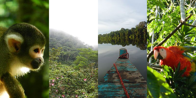
Getting closer to the foothills of the Andean highlands to the west and with increasing altitude, temperatures become cooler. Above elevation of around 1,500m (5,000 feet) the climate transitions to sub-tropical with spring-like weather year-round and in some areas - merging with the climate of the Andean highlands - even show pronounced dry and rainy seasons.
Best time to travel to Peru
As described above, Peru’s unique combination of geographic and topographic conditions results in various climates, making it impossible to find the perfect time with the best weather for the entire country.
While you can expect the perfect, warm, and sunny weather during the southern hemisphere summer from December to April along the Peruvian coast and in Lima, that’s surely not the ideal time to travel to the Andean highlands including Cusco and Machu Picchu as it’s rainy season.
On the other hand, the best time to travel to the Andean highlands and the Amazon rainforest is during the dry / drier season between June and August in the southern hemisphere winter; but during this period the weather along the coast and in Lima is not really inviting as it’s cool, damp and foggy.


